
Mary River
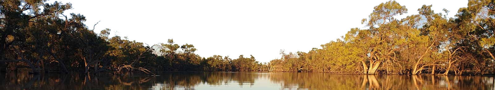
The Mary River is a major river system in South East Queensland, flowing from the Conondale Range near Maleny in the Sunshine Coast hinterland, where it heads west before turning north up past Gympie and out into the shealthered waters of Great Sandy Strait. Picturesque scenery and abundant wildlife make for an excellent paddling experience, from day trips to a longer multi-day trips for more experienced paddlers.
There is a great chance at spotting rare Mary River Cod, anciant Australian Lungfish, platypus and Mary River Turtle as you glide down the river with plenty of oppunities to stop for a picnic on the gravel beaches or grassy banks of the parks along the way, but remember that most of the river passes through private property, so be respectful and stick to the waterways as you pass on by.
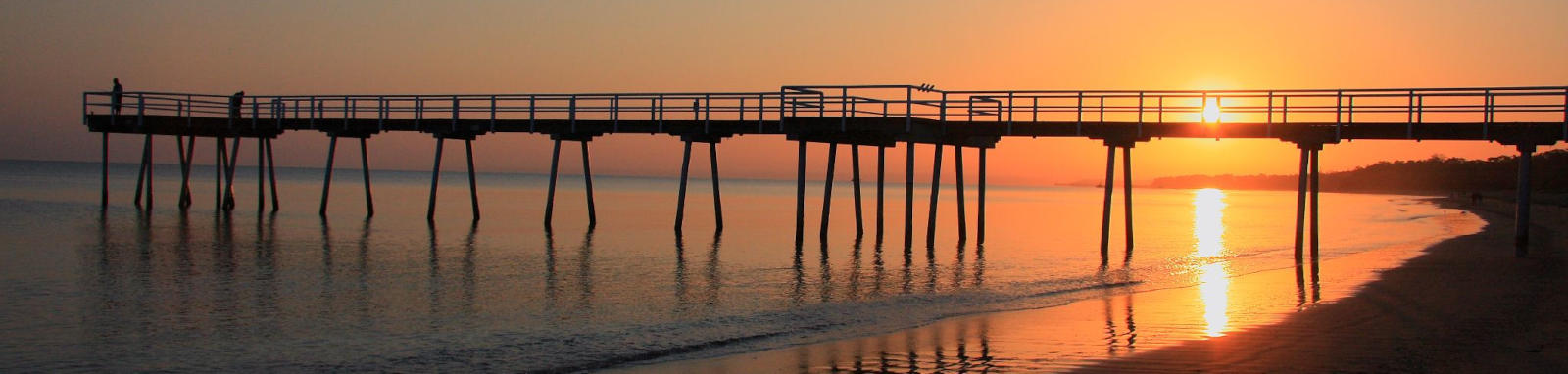
The river passes through a number of towns including Conondale, Kenilworth, Gympie, Tiaro and Maryborough before entering the Great Sandy Strait at River Heads. Great Sandy Strait is a tidal passage of water between the mainland and K'gari (Fraser Island), which is 18 km south of Hervey Bay.
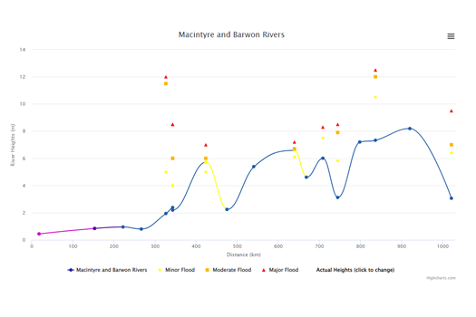
The Mary River has several major tributaries including Obi Obi, Yabba, Kandanga, Amamoor, Six Mile, Widgee, Wide Bay, Munna, and Tinana creeks and is bounded by the Conondale, Jimna and Burnett Ranges. The steep terain makes it suceptable to flooding with the heavy summer moonsonal rains. The Mary and surrounding Waterways can rise quickly and the flow can be dangerous even for experienced paddlers.
The Mary River flows through the traditional lands of the Kabi Kabi (Gubbi Gubbi) people that knew the river as the Moocooboola. The river was initally named the Wide Bay River by early European settlers before it was renamed to the Mary after Lady Mary Lennox, the wife of the NSW Governer at the time. Early foresty and gold mining in the area has given way to farming on the rich fertile soils found along the river as well as tourism particularily up in the mostly untouched upper reaches.
Tinana Creek is an important sub-catchment area within the basin (1,190 sq km)
Some additional information to ensure an enjoyable and successful trip.


Dangers
As well as the normal dangers associated with river transportation, the Mary River has a few additional dangers.
The first is common in many of the estuarine areas in tropical waters, namely Bull Sharks. While attacks are rare, care should be taken especially in murky water.
The second being crocodiles. While this is not naturally part of their habitat, it does mark the southern point of where crocodiles have been known to naturally colanise. Three crocodiles were seen in the early 2010's, including a 3.5 m salty.
Tides
The tide will affect most locations below the barrage with the strongest tidal current seen at River Heads.
Tidal info for Mary River Entrance
- HAT
- 4.90 m
- MSL
- 2.39 m
- MHWS
- 3.80 m
- MHWN
- 3.10 m
- MLWN
- 1.50 m
- MLWS
- 0.70 m
September
22
Mon
03:00
0.77 m
09:15
3.58 m
15:19
0.94 m
21:16
3.76 m
September
23
Tue
03:28
0.75 m
09:43
3.62 m
15:50
0.99 m
21:44
3.71 m
September
24
Wed
03:53
0.75 m
10:09
3.63 m
16:21
1.08 m
22:14
3.63 m
September
25
Thu
04:19
0.77 m
10:36
3.63 m
16:54
1.20 m
22:45
3.51 m
Tides for selected locations on the lower Mary River for Monday, 22nd September
Beaver Rock Ramp
04:17
0.77 m
10:04
3.58 m
16:36
0.94 m
22:05
3.76 m
Saltwater Creek
05:13
0.77 m
10:26
3.58 m
17:32
0.94 m
22:27
3.76 m
Maryborough Jetty
05:41
0.77 m
10:45
3.58 m
18:00
0.94 m
22:46
3.76 m
Tinana Creek
05:52
0.77 m
10:55
3.58 m
18:11
0.94 m
22:56
3.76 m
Bruce Highway
06:07
0.77 m
11:12
3.58 m
18:26
0.94 m
23:13
3.76 m
The Barrage
07:28
0.77 m
11:35
3.58 m
19:47
0.94 m
23:36
3.76 m
Tide predictions are estimates only. The tidal datum is for Ungowa. Tide predictions are calculated from Ungowa with times adjusted by minus 15 minutes for low tide and minus 15 minutes for high tide. Other locations use a similar offset calculation.
Please refer to the Bureau of Meteorology and Australian National Tide Tables for official tidal information.
© Commonwealth of Australia
Please refer to the Bureau of Meteorology and Australian National Tide Tables for official tidal information.
© Commonwealth of Australia
Quick Stats
- Length
- 310 km
- Navigable
- 207 km
- Catchment
- 1,190 sq km
- Technical difficulty
- Grade I - II
Current Flow
- Moy Pocket
- 0.81m / 113 MLD
- Fishermans Pocket
- 1.87m / 171 MLD
- Sexton
- 1.78m / 363 MLD
- The Barrage
- No Data

- Time
- 4 to 7 days
from Traveston Crossing - Elevation Loss
- Dangers
- Strainers and logs in the upper sections. Low bridges, weir, barrage and occassional crocs.
- First Nations
- Kabi Kabi
The Mary was know as the MoocooboolaButchulla
Lowland areas around the Great Sandy StraitJinibara
The mountain people around the source - Directions To
- River Head
Maryborough
Gympie
Conondale